Stormy weather damages Clinton homes
By Randy Bell

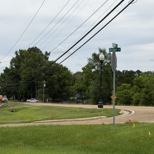
A fallen tree is shown after being cut away from the lanes of traffic on the Natchez Trace just south of I-20 on April 6. The tree fell on a truck, trapping and injuring the driver.
A severe storm packing strong winds, heavy rain and an incredible amount of lightning left behind some scattered damage and caused at least one injury after slamming into Clinton just after midnight April 6.
A motorist was hurt while driving on the Natchez Trace Parkway during the storm.
“We had a tree on a truck, trapping one person in it,” says Fire Chief Jeff Blackledge. “We had to extricate them.”
Blackledge says it’s his understanding that the victim suffered an arm injury. The large oak tree fell across the Parkway just south of I-20.
Firefighters were prepared to make another rescue after getting a call about a tree falling on a home on Countrywood Circle off Clinton-Raymond Road.
“[It was] reported to us as having [children] trapped on the second floor,” Blackledge says. “When our guys got there, we found out there wasn’t anybody trapped.”
According to the chief, another tree fell on an unoccupied car parked at a home near the corner of Abby Oak and Red Oak off Springridge Road, and he says there were a few other trees down across Clinton.
There was no indication from the National Weather Service (NWS) of a tornado touching down in the city, and the tree damage apparently was the result of straight-line thunderstorm winds.
But that wasn’t the only the problem resulting from the storm.
“We wound up with two structure fires caused by lightning,” Blackledge says.
One of the fires was on Clinton-Tinnin Road and the other on Glen Hollow Drive in the Woodmoor neighborhood.
“Minimal damage to both structures,” the chief notes.
Mike Edmonston, a lead forecaster at the National Weather Service office in Jackson, says it’s a complicated process to explain why there was so much thunder and lightning in the storm.
“Generally, it has to do with how strong the updrafts are, how high up we can get the moisture and how cold it is aloft for electrification,” said Edmonston.
Edmonston says a slow-moving cold front encountered a warm, moist and unstable airmass in Mississippi as it moved across the state late Saturday and early Sunday.
“And that gave the storms plenty of time to develop and electrify. I noticed the polarity of the lightning, too. There were a lot of positive strokes compared to the negative strokes. And, generally, the positive lightning strokes are louder and more noticeable than the negative strokes.”
According to the National Oceanic and Atmospheric Administration’s (NOAA) website, “negative lightning” – which is the most common – forms under a thunderstorm’s base, while “positive lightning” originates near the top of the storm. NOAA says the electric fields associated with positive cloud to ground lightning strikes are typically much stronger than those associated with negative strikes and can cause greater damage. And the flash duration is longer, dramatically lighting up the sky.
The April 6 storm also produced more than four inches of rain in parts of Clinton over the course of a few hours. But Blackledge says he didn’t receive any reports of flash flooding across the city.
Edmonston points out that, with the initial storm and the ones that followed not moving very quickly, significant rainfall accumulations were common.
“It was slow enough where the storms would train over the same area, and they had high water content in them, so it laid down a pretty good swath [of heavy rain.]”